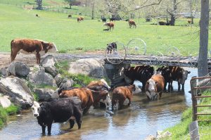
For many years, one of the most important, unanswered questions in the Chesapeake Bay cleanup has been: To what extent are farmers actually implementing pollution control practices, such as fencing cattle out of streams? How often are farmers maintaining strips of grasses and trees as green filters along waterways? These are the most cost-effective ways to reduce the nitrogen and phosphorus pollution that are impairing the nation’s largest estuary, but not enough information is collected about how often these strategies are employed.
To help clear up these questions, EIP used highly detailed Google Earth satellite images, combined with county tax maps and EPA’s computerized mapping of streams, to calculate what percentage of farms in one of Virginia’s biggest agricultural counties—Augusta County, in the Shenandoah Valley—fenced their cattle out of streams on their property. Augusta County has about 95,000 beef cattle, the second most of any county in Virginia, and fourth most in the bay watershed. In 2016, the nonprofit Shenandoah Riverkeeper organization performed a similar survey in neighboring Rockingham County (the state’s largest agricultural county, with 110,868 cattle).


